From melted glaciers to wildfire recovery, NASA has released a library of images documenting the environmental impact humans and natural disasters are having on many areas around the world. The photos, some taken many decades ago, show dramatic changes in urban places, landscapes, lakes, mountains, and more.
Here are a few of those before and after pictures showing environmental impacts with the dates and stories behind them. Learn more about this project and find scientific articles, resources, and news about earth changes on the NASA website.
Urban expansion in New Delhi, India
March 14, 1991 - March 2, 2016
Before

After
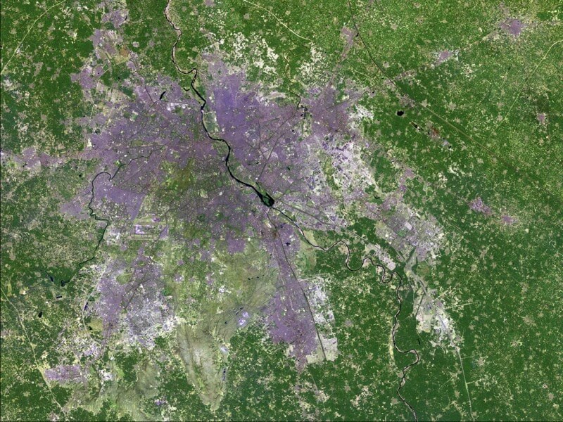
Between 1991 and 2016, the population of New Delhi, India’s capital and its suburbs, grew from 9.4 million to 25 million. These two images show the dramatic impact that the growth has had on the area. A recent United Nations report predicts Delhi will have around 37 million residents by 2030.
Images taken by the Thematic Mapper on board Landsat 5 and the Operational Land Imager onboard Landsat 8. Source: U.S. Geological Survey (USGS) Landsat Missions Gallery; “New Delhi Among Fastest Growing Urban Areas in the World;” U.S. Department of the Interior / USGS and NASA.
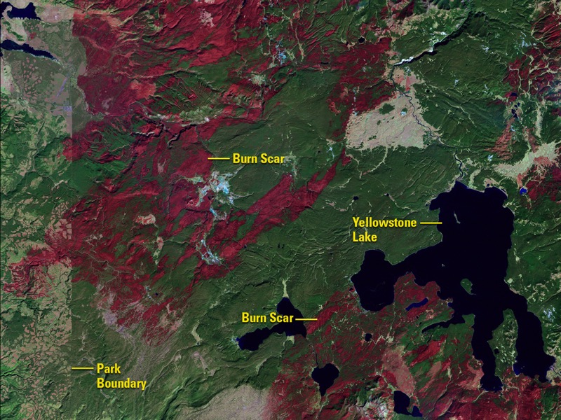
Yellowstone National Park Fire and Recovery
October 10, 1988 - June 17, 2016
Before
After
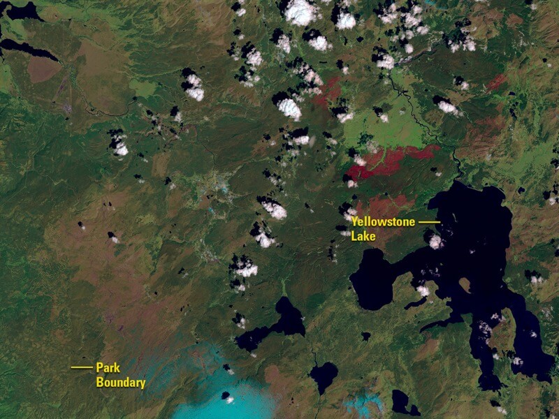
In 1988 a wildfire ripped through Yellowstone National Park and affected over one-third of the park, completely closing it for the first time so that emergency personnel could contain the fire. The first image, from 1988, shows the damage done by the fire while the second photo, taken in 2016, shows the recovery of trees and other vegetation.
Images taken by the Thematic Mapper onboard Landsat 5 and the Operational Land Imager onboard Landsat 8. Source: U.S. Geological Survey (USGS) Landsat Missions Gallery; “Fire and Rebirth: Landsat Tells Yellowstone’s Story”; U.S. Department of the Interior / USGS and NASA.
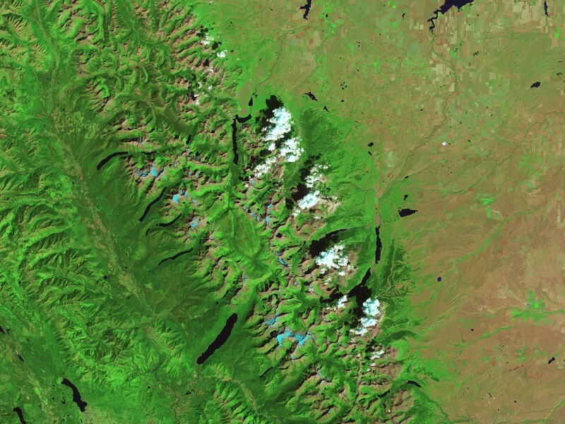
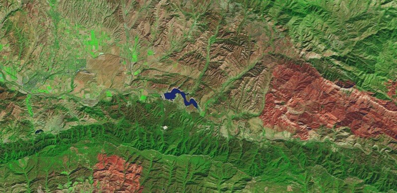
Melting glaciers in Glacier National Park, Montana
August 17, 1984 - August 23, 2015
Before
After
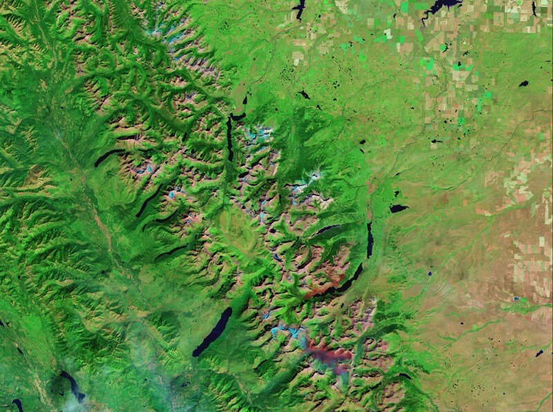
Montana’s Glacier National Park, in the Rocky Mountains, had roughly 150 glaciers in 1850, 83 in 1968, and only 25 today. These images show the permanent snow and ice change (blue bodies) in the central area of the park. You can also see burn scars in the 2015 photo from previous wildfires.
Images taken by the Thematic Mapper onboard Landsat 5 and the Operational Land Imager onboard Landsat 8. Source: NASA Earth Observatory.
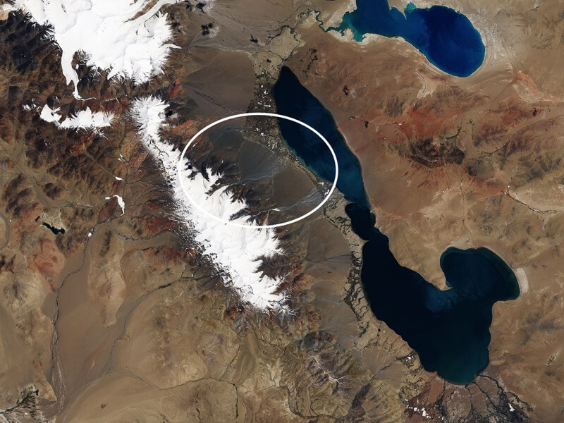
Ice avalanche in Tibet’s Aru Range
June 24, 2016 - July 21, 2016
Before
After
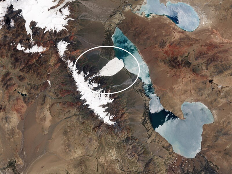
On July 17, 2016, a glacier tongue collapsed and sent a massive avalanche of ice and rock down into a narrow valley in Tibet’s Aru Range. The remote village of Dunru lost 9 people as well as hundreds of sheep and yaks. The ice avalanche, one of the largest ever recorded, left a debris field behind that was 98 feet thick in some places and 4 square miles across.
Images taken by the Operational Land Imager onboard Landsat 8 and ESA’s Sentinel-2. Source: NASA’s Earth Observatory.
Porcupine Glacier calves in British Columbia
August 25, 2015 - August 27, 2016
Before
After
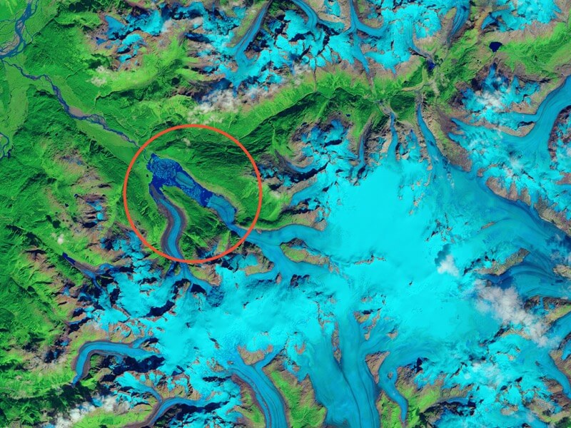
These two pictures were taken in shortwave infrared light, to help distinguish between ice, snow, and water. The image change shows a giant iceberg that has broken off of the Porcupine Glacier in northern British Columbia. Mauri Pelto, a glaciologist who has been analyzing satellite image of glaciers since the 1980s, states that it’s the largest iceberg (by area) to calve from a North American glacier in recent decades - splitting from ice floating on water rather than ice supported by solid ground.
Images taken by the Operational Land Imager onboard Landsat 8. Source: NASA Earth Observatory.
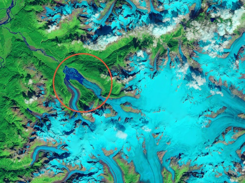
Landslide in Glacier Bay National Park and Preserve, Alaska
September 13, 2015 - August 7, 2016
Before
After
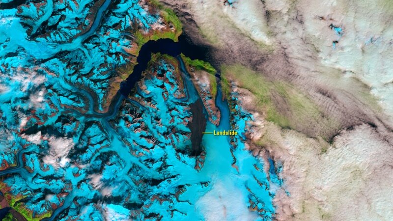
These two photos show a 4,000-foot-high mountainside in Glacier Bay National Park and Preserve, Alaska completely collapse. The landslide dropped rocky debris equivalent to 60 million mid-size SUVs onto the Lamplugh Glacier.
Images taken by the Operational Land Imager onboard Landsat 8. Source: U.S. Geological Survey (USGS) Landsat Missions Gallery; U.S. Department of the Interior / USGS and NASA.
Lake Cachuma, Southern California Drought
October 27, 2013 - October 19, 2016
Before
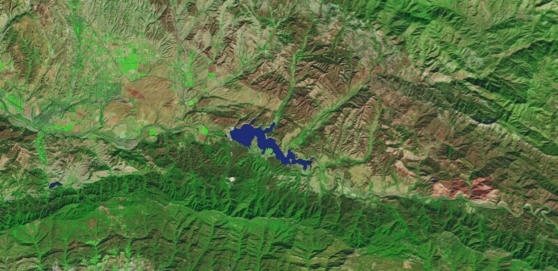
After
The drought in Southern California has contributed to the water in Lake Cachuma falling to about 7 percent capacity, exposing much of the bottom of the reservoir. These two pictures, taken 3 years apart, shows the change in the water levels during this time.
Images taken by the Operational Land Imager onboard Landsat 8. Source: NASA Earth Observatory.
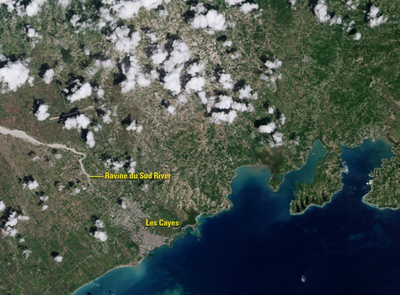
The effects of Hurricane Matthew in southwestern Haiti
September 26, 2016 - October 12, 2016
Before
After
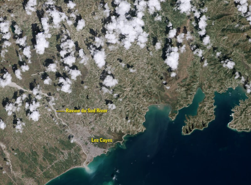
On October 4, 2016, Hurricane Matthew pounded southwestern Haiti, destroying crops, vegetation, and affecting hundreds of thousands of homes and their families. The two images show the damage done by the storm and the 30 inches of rain it brought to the area.
Images taken by the Operational Land Imager onboard Landsat 8. Source: U.S. Geological Survey (USGS) Landsat Missions Gallery; U.S. Department of the Interior / USGS and NASA.
European gypsy moth caterpillars damage forests across Northeastern U.S.
July 11, 2015 - July 13, 2016
Before
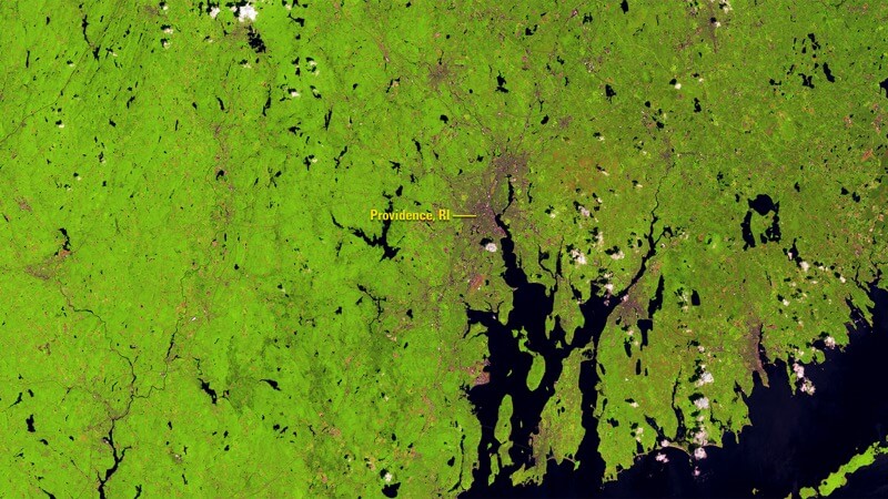
After
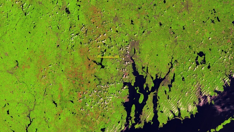
Two dry subsequent spring seasons and a drought in the Mid-Atlantic region of the U.S. weakened ground-dwelling fungus that can kill the European gypsy moth caterpillar. This led to an outbreak in the spring/summer of 2016, with the caterpillars devastating forests all across the area. The two pictures show the countryside around Providence, Rhode Island and the damage done to the healthy forest (light green).
Images taken by the Operational Land Imager onboard Landsat 8. Source: U.S. Geological Survey (USGS) Landsat Missions Gallery; U.S. Department of the Interior / USGS and NASA.
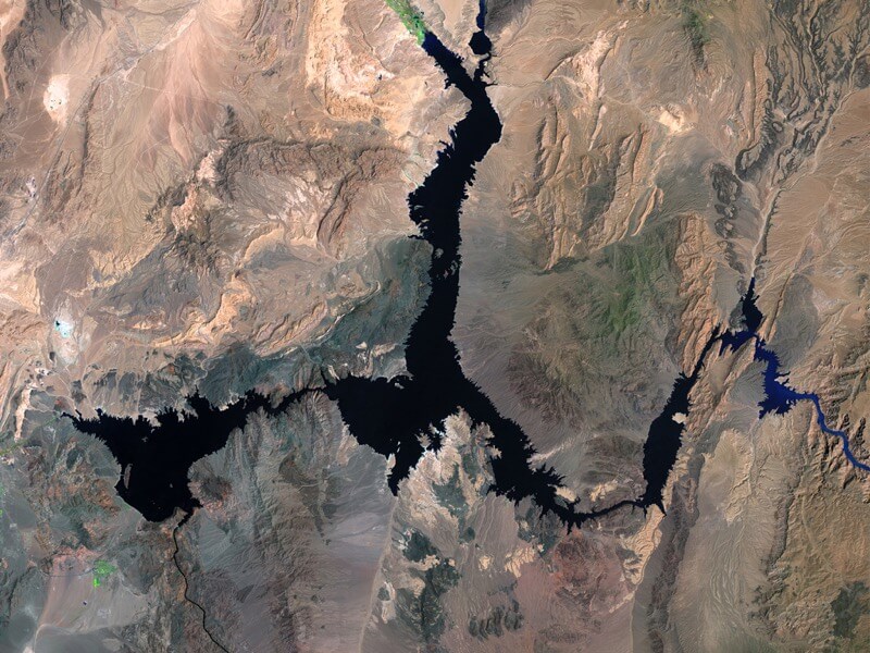
Lake Mead water loss
May 15, 1984 - May 23, 2016
Before
After

A 16 year drought in the Colorado River Basin has caused Lake Mead to fall to the lowest level since it began filling in the 1930s. The first image, taken in 1984, shows the reservoir almost full while the second photo, taken in 2016, shows it around 37 percent capacity. Learn more about the environmental impacts of the Colorado River Basin drought on the NOAA website.
Images taken by the Thematic Mapper on board Landsat 5 and the Operational Land Imager onboard Landsat 8. Source: U.S. Geological Survey (USGS) Landsat Missions Gallery; Lake Mead Reaches Historic Low; U.S. Department of the Interior / USGS and NASA.
Nepal’s Imja Glacier melt
Autumn, circa 1956 - October 18, 2007
Before

After
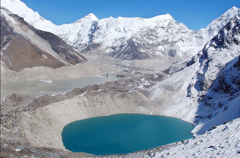
Imja Glacier, near Mt. Everest in the Himalayas, has been melting over the past 50 years, slowly filling up Imja Lake, which became a body of water in the 1970s. This lake threatens to flood downstream communities if its unstable natural dam of dirt and rocks cemented by ice gives way. You can see the dramatic change of the area in these two images from 1956 and 2007. The threat of flooding is not going unnoticed though, as the United Nations has started a project to lower the lake level.
Images: 1956 picture courtesy of the Association for Comparative Alpine Research, Munich; photo taken by Erwin Schneider. 2007 picture courtesy of the Archives of Alton Byers and the Mountain Institute; photo taken by Alton Byers. Sources: “Nepal’s Imja Lake, Khumbu Region, Appears Resilient Against Gorkha Quake” and United Nations Development Programme.
Urban growth in Hurghada, Egypt
January 28, 1985 - November 28, 2014
Before

After
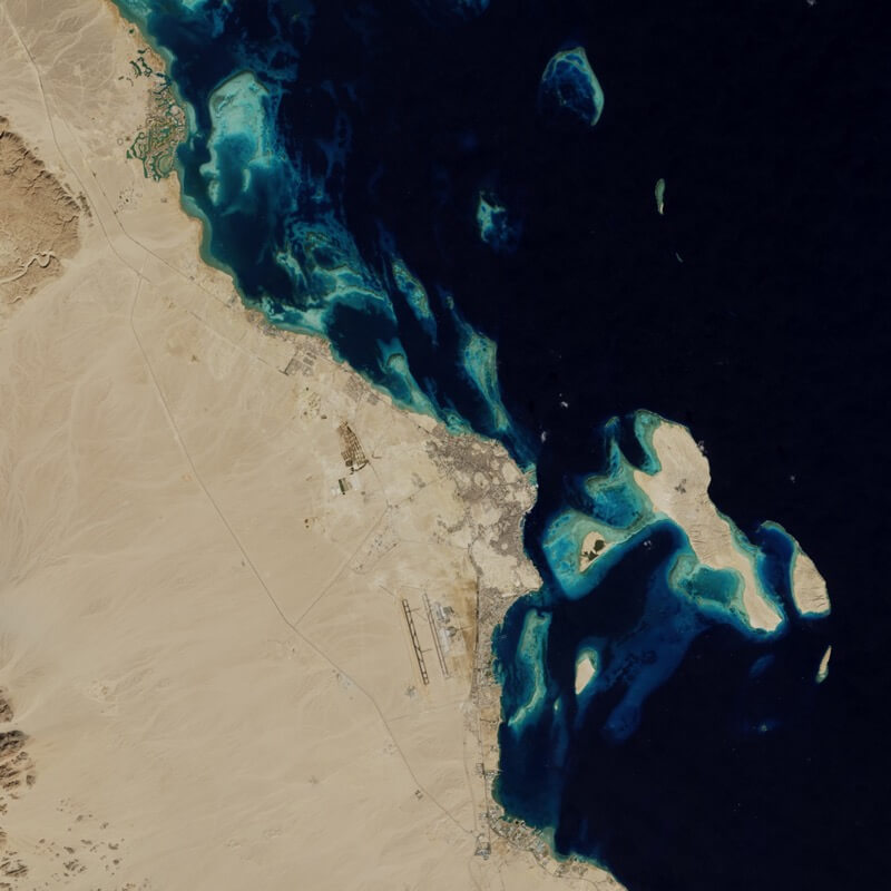
Only 12,000 people lived in Hurghada, Egypt in the 1980s. Now, it’s home to more than 250,000 people and because the area has some of the world’s best diving and snorkeling, over 1 million tourists visit every year. The environmental impact has been massive, with coral reef ecosystems near Hurghada declining by almost 50 percent in just three decades.
Images taken by the Thematic Mapper onboard Landsat 5 and the Operational Land Imager onboard Landsat 8. Source: NASA’s Earth Observatory.
See more before and after images of change and the stories behind them on the NASA website.
